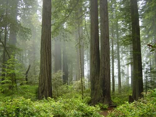
North Carolina shares its one national park with Tennessee, but it’s a big one: Great Smoky Mountains, the most-visited national park in the entire country, straddling the state line along the Appalachian ridge. More than 12 million people pass through the park each year, and it charges no traditional entrance fee at all, a rarity that traces back to the deed restrictions on the land itself when the park was assembled nearly a century ago.
Here’s the practical guide to North Carolina’s national park: where it sits, what it costs, the numbers behind its record-setting visitation, and the history behind both its no-fee tradition and its North Carolina-side access points.
Great Smoky Mountains National Park Overview
| Category | Details |
| Location | Southern Appalachian Mountains, straddling North Carolina and Tennessee |
| NC gateway towns | Cherokee, Bryson City |
| Nearest airport | Asheville Regional Airport (AVL), NC side |
| Established | Authorized 1934; dedicated by President Franklin Roosevelt in 1940 |
| Total area | About 522,000 acres (roughly half in North Carolina) |
| Entrance fee | None — the park has never charged a traditional entrance fee |
| Parking tag (required for stays over 15 minutes) | $5 daily, $15 weekly, $40 annual |
| Highest peak | Kuwohi (formerly Clingmans Dome), 6,643 feet, on the NC/TN border |
| Appalachian Trail within park | About 71 miles |
| Annual visitation | Over 12 million, the most-visited national park in the U.S. |
Where the North Carolina Side of the Park Is Located
Great Smoky Mountains straddles the border between western North Carolina and eastern Tennessee, spanning roughly 54 miles from the Pigeon River to the Little Tennessee River. On the North Carolina side, the town of Cherokee serves as the main entrance point, sitting adjacent to the Qualla Boundary, the sovereign land of the Eastern Band of Cherokee Indians, while Bryson City offers another nearby gateway with lodging and services.
Asheville Regional Airport is the most convenient air access point for the North Carolina side, with roughly an hour’s drive to reach Cherokee. Newfound Gap Road connects the North Carolina and Tennessee sides directly through the park, climbing to over 5,000 feet at its highest point and offering one of the most scenic drives in the eastern United States.
What It Actually Costs to Visit
Great Smoky Mountains has never charged a traditional entrance fee, a direct legacy of how the land was assembled in the 1930s, through private donations and land purchases rather than existing federal territory, with deed restrictions prohibiting admission charges. What changed in 2023 is parking. The park’s “Park it Forward” program now requires a valid parking tag for any vehicle parked longer than 15 minutes anywhere within the park boundary, including on the North Carolina side. A daily tag costs $5, a weekly tag costs $15, and an annual tag costs $40, and one tag covers parking anywhere in the park regardless of which state side you’re visiting.
Simply driving through the park without stopping to park doesn’t require a tag. The America the Beautiful Pass does not substitute for a parking tag, since the park has no entrance fee for the pass to waive. Tags can be purchased at visitor centers, automated kiosks, or online in advance through Recreation.gov.
Facts That Define the North Carolina Side of the Smokies
The North Carolina side holds Kuwohi, the park’s highest point at 6,643 feet, sitting right on the border with Tennessee and reachable via a steep but short half-mile paved trail from the parking area to the summit observation tower. The Oconaluftee Visitor Center near Cherokee anchors the North Carolina entrance, offering access to historic farm buildings and trailheads into the park’s southern reaches.
The Cherokee side of the park carries deep cultural significance, since the Eastern Band of Cherokee Indians maintains ancestral ties to this land that predate any federal designation by well over a thousand years. The park’s distinctive blue-gray haze, the source of its name, comes from natural vapors released by the dense temperate rainforest canopy that covers much of the North Carolina slopes.
The History Behind the Park’s North Carolina Side
Unlike most western parks carved from land the federal government already controlled, Great Smoky Mountains required an unusually complicated land assembly process on both sides of the state line. Thousands of small farms and logging operations had to be purchased and vacated across North Carolina and Tennessee, funded largely through private donations, including a crucial $5 million contribution from the Rockefeller family. Congress authorized the park in 1934, and President Franklin Roosevelt formally dedicated it in 1940.
Long before any of that federal history, the Cherokee people had lived in these mountains for well over a thousand years. That deep connection was formally acknowledged in September 2024, when the U.S. Board on Geographic Names voted to restore the highest peak’s original Cherokee name, Kuwohi, meaning “mulberry place,” replacing the name Clingmans Dome, which had honored a Confederate general since 1859. The renaming came after years of advocacy from the Eastern Band of Cherokee Indians, and the National Park Service now closes the peak for three days each year specifically so Cherokee students can visit and learn its history directly from tribal elders.
Frequently Asked Questions
Q1. Is entering from the North Carolina side different from entering through Tennessee?
No, the park charges the same no-entrance-fee, parking-tag system regardless of which state side you enter from. The main practical difference is which towns and trailheads you’re closest to, Cherokee and Bryson City on the NC side versus Gatlinburg on the Tennessee side.
Q2. Does the parking tag guarantee me a spot at popular North Carolina trailheads?
No. The tag only permits your vehicle to park legally within the park; it doesn’t reserve a specific space. Popular North Carolina trailheads near Cherokee and Kuwohi fill up quickly, especially on weekends, so arriving early remains the best strategy.
Q3. What’s the best way to see Kuwohi from the North Carolina side?
A steep but short half-mile paved trail leads from the parking area to the observation tower at the summit, accessible via Newfound Gap Road. It’s demanding due to the elevation gain, but far shorter than most alpine summit hikes elsewhere in the park system.
Q4. Are pets allowed on North Carolina-side hiking trails?
No, pets are restricted to just two trails in the entire park, both paved and relatively short, regardless of which state side you’re on. This is stricter than most national parks, so travelers hiking with dogs should check current pet policies before their trip.