A national park superintendent convinced the Secretary of the Interior to back an entirely new park not through formal lobbying, but through what historians now call “Dutch oven diplomacy”: campfire dinners, Jeep tours, and shared meals out in the Utah desert. That’s how Canyonlands came to exist, a sprawling landscape of red-rock canyons, mesas, and spires carved by two of the American West’s most legendary rivers, the Green and the Colorado, meeting at a confluence one cabinet secretary reportedly fell in love with from an airplane window.
Here’s the practical guide for planning a visit: where the park sits, what it costs, the numbers behind its four wildly different districts, and the persuasive campfire diplomacy that got it protected in the first place.
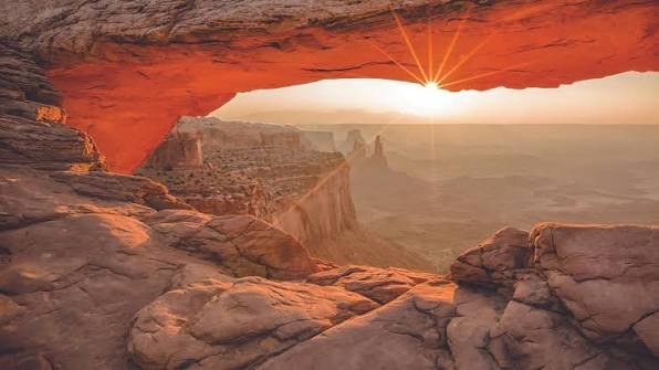
Canyonlands National Park Overview
| Category | Details |
| Location | Southeastern Utah, Colorado Plateau |
| Counties | San Juan, Wayne, Garfield, and Grand |
| Nearest city | Moab, UT |
| Nearest airport | Canyonlands Regional Airport (CNY), Moab |
| Established | September 12, 1964; boundaries expanded 1971 |
| Total area | About 337,600 acres — the largest national park in Utah |
| Vehicle entrance fee | $30, valid 7 consecutive days |
| International visitor surcharge | None — Canyonlands is not among the surcharge parks |
| Southeast Utah Group Annual Pass | Covers Arches, Canyonlands, Hovenweep, and Natural Bridges |
| America the Beautiful Annual Pass | $80 (all U.S. national parks) |
| Districts | Island in the Sky, the Needles, the Maze, and the Rivers |
| Cataract Canyon length | 14 miles of whitewater below the confluence |
| Dark sky status | Gold-Tier International Dark Sky Park |
| Annual visitation | Around 800,000 visitors |
Where Canyonlands National Park Is Located
Canyonlands sits in southeastern Utah near Moab, the same gateway town that serves nearby Arches National Park, though Canyonlands itself covers far more ground, roughly 337,600 acres, making it the largest national park in the state. Canyonlands Regional Airport serves the immediate area, though many visitors fly into Salt Lake City or Grand Junction, Colorado, and drive the remaining distance.
The park splits into four genuinely distinct districts, divided by the Green and Colorado Rivers, and importantly, none of them connect to each other by road within the park. Island in the Sky, the northernmost and most accessible district, sits on a high mesa between the two rivers and draws the majority of day-trip visitors from Moab. The Needles district lies east of the Colorado River and offers more extensive backcountry hiking. The Maze, to the west, is famously remote, reachable only via rough dirt roads requiring four-wheel drive, and much of it accessible only on foot. The fourth district is simply the rivers themselves, including Cataract Canyon, a stretch of serious whitewater below the confluence.
Because of this fragmented layout, most visitors pick a single district to focus on rather than attempting to see all four in one trip, and Island in the Sky’s proximity to Moab makes it the natural starting point for first-time visitors.
What It Costs to Visit
A standard vehicle pass costs $30, covering everyone inside for seven consecutive days. Unlike several nearby Utah parks, Canyonlands is not among the eleven national parks currently charging the additional $100 nonresident surcharge, meaning entrance costs stay the same regardless of a visitor’s country of residence.
Anyone spending extended time in the Moab area might consider the Southeast Utah Group Annual Pass, which covers Canyonlands alongside Arches National Park and the nearby Hovenweep and Natural Bridges National Monuments, a strong value for a longer regional trip. Travelers planning a broader national park itinerary typically prefer the $80 America the Beautiful Pass instead, which covers admission to every federal recreation site nationwide.
Backcountry permits are required separately for any overnight hiking or off-road camping within the park’s more remote districts, and checking in with a backcountry ranger station before heading into areas like the Maze is strongly recommended given how isolated that terrain can be.
Facts That Make Canyonlands Unique
The park’s four districts share a primitive desert character but offer genuinely different experiences. Island in the Sky sits atop a broad sandstone mesa between the rivers, offering sweeping overlooks at spots like Grand View Point and access to the dramatic White Rim Road. The Needles district takes its name from colorful banded rock spires scattered across its terrain, while the Maze earns its reputation as one of the most remote and rugged areas in the entire National Park System, a 30-square-mile tangle of sheer-walled canyons that twist and divide back upon themselves.
Below the confluence of the Green and Colorado Rivers, the water forms Cataract Canyon, a 14-mile stretch of serious whitewater rapids that draws experienced rafters for multi-day trips. Canyonlands also holds Gold-Tier International Dark Sky Park status, reflecting minimal light pollution and exceptional stargazing conditions across its remote terrain.
The renowned author and desert advocate Edward Abbey, a frequent visitor, once described Canyonlands as “the most weird, wonderful, magical place on earth—there is nothing else like it anywhere,” a sentiment that still resonates with visitors encountering the park’s four wildly different landscapes for the first time.
The History Behind Canyonlands National Park
The push to protect this land traces directly back to Bates Wilson, superintendent of nearby Arches National Monument during the early 1950s, who began exploring the canyon country south and west of Moab and grew captivated by what’s now the Needles district. Wilson expanded his advocacy over subsequent years to include the confluence of the Green and Colorado Rivers, the Maze district, and Horseshoe Canyon, building support through what became known as his “Dutch oven diplomacy,” informal campfire dinners and Jeep tours meant to win over skeptical officials and locals alike.
That approach worked. In 1961, Interior Secretary Stewart Udall flew over the confluence of the two rivers en route to a conference at Grand Canyon National Park, and the view reportedly sparked his enthusiasm for Wilson’s proposal. Utah Senator Frank Moss introduced legislation to establish the park, and despite considerable opposition within the state, President Lyndon Johnson signed the act creating Canyonlands National Park on September 12, 1964, making it the 32nd national park in the country and setting aside an initial 257,640 acres.
The park’s boundaries expanded to their current size in 1971, adding additional acreage to protect the area’s full scenic and scientific value. Long before any of this federal history, the land carried evidence of Archaic and Ancestral Puebloan presence, including petroglyphs still visible throughout the park, and explorer John Wesley Powell had already charted the Green and Colorado Rivers through this exact terrain during his famous expeditions in 1869 and 1871, decades before anyone proposed formal federal protection.
Frequently Asked Questions
Q1. Can I drive between the different districts within the park?
No. None of the four districts connect by road within the park itself. Traveling between them, say from Island in the Sky to the Needles, requires driving around outside the park, often taking well over an hour depending on the route.
Q2. Do I need a high-clearance vehicle to visit the Maze district?
Yes, and often a genuine 4WD vehicle at that. The Maze is accessed via rough dirt roads unsuitable for standard passenger cars, and much of the district requires hiking on foot once you arrive, so this isn’t a casual day-trip destination like Island in the Sky.
Q3. Is white-water rafting through Cataract Canyon something I can do independently?
Generally no for most visitors. Cataract Canyon’s rapids are serious enough that most people go with a licensed outfitter offering multi-day guided trips, rather than attempting the stretch independently without significant whitewater experience.
Q4. What’s the easiest district to visit if I only have one day and I’m not an experienced backcountry hiker?
Island in the Sky is by far the most accessible, offering paved roads, developed overlooks, and shorter day hikes reachable within a short drive of Moab, making it the natural choice for a single-day visit without backcountry experience.