Not every national park makes you ride a bus to see its best parts, and that alone tells you something about Zion. During peak season, private vehicles simply aren’t allowed onto Zion Canyon’s main scenic drive — the shuttle is the only way in, winding beneath sandstone walls that climb 2,000 feet straight up on either side. It’s an unusual arrangement, but once you’re inside the canyon looking up at cliffs the color of rust and honey, the logic makes sense. There’s only so much room down there, and a lot of people want to see it.
If you’re mapping out a Utah trip, here’s what to know before you go: where Zion sits, what it costs, the numbers that define it, and the century-long path that turned a Mormon settlement into one of the busiest national parks in the country.
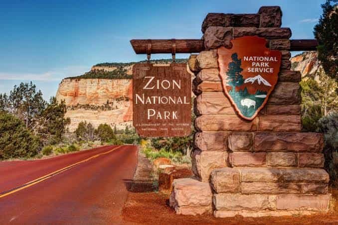
Zion National Park Overview
| Category | Details |
| Location | Southwestern Utah, near Springdale |
| Counties | Washington, Kane, and Iron |
| Nearest city | Springdale (south entrance), Cedar City (Kolob Canyons entrance) |
| Nearest airports | St. George Regional (SGU), Las Vegas Harry Reid International (LAS) |
| Established | November 19, 1919 — Utah’s first national park |
| Total area | About 146,600 acres (roughly 229 square miles) |
| Vehicle entrance fee | $35, valid 7 consecutive days |
| Motorcycle fee | $30 |
| Per-person fee (foot/bicycle) | $20 |
| Zion Annual Pass | Available, covers pass holder + vehicle passengers for 12 months |
| America the Beautiful Annual Pass | $80 (all U.S. national parks) |
| International visitor surcharge (2026) | $100 per person, age 16+ (waived with a qualifying annual pass) |
| Zion Canyon Shuttle | Free, no ticket or reservation needed, runs March–November |
| Highest point | Horse Ranch Mountain, 8,726 feet |
| Lowest point | Coalpits Wash, 3,666 feet |
| Main canyon length | About 15 miles, up to half a mile deep |
| Annual visitation | Roughly 4.5–5 million visitors |
| Park hours | Open 24/7, 365 days a year |
Where Zion Is Located and How to Reach It
Zion sits in the southwestern corner of Utah, spread mainly across Washington County with slivers extending into Kane and Iron counties. Most visitors arrive through the south entrance near Springdale, a small gateway town that essentially exists to serve the park — restaurants, lodging, and outfitters line the main road right up to the pedestrian entrance.
There’s also a separate, quieter entrance at Kolob Canyons in the park’s northwest corner, closer to Cedar City, which sees a fraction of the traffic the main canyon does. If you’re coming from Las Vegas, it’s about a two-and-a-half-hour drive, making Zion a popular addition to Southwest road trips that also hit the Grand Canyon or Bryce Canyon.
Zion is unusual among major parks in that it never closes. It’s open every day of the year, though what changes with the seasons is which roads are drivable and whether the shuttle system is running.
What It Costs to Visit Zion
The entrance structure mirrors most other national parks: $35 for a private vehicle, covering everyone inside for seven consecutive days. Motorcycles pay $30, and visitors on foot or bicycle pay $20 per person.
Frequent visitors can pick up a Zion-specific annual pass, while anyone planning to hit multiple national parks within the year tends to go with the $80 America the Beautiful Pass, covering entry to every federal recreation site nationwide.
As with several other high-traffic parks, 2026 brought a notable change for non-U.S. residents. Visitors aged 16 and older who aren’t U.S. citizens or residents now pay an additional $100 surcharge on top of the standard entrance fee, unless they hold a qualifying non-resident annual pass, which runs $250 and covers up to four adults traveling together. For a family or small group visiting from abroad, that pass usually works out far cheaper than paying the surcharge per person at the gate.
One cost that catches people off guard: the canyon shuttle itself is completely free, no ticket or reservation required, but parking in Springdale during peak season runs on a paid, zoned system, and spots inside the park fill by mid-morning on busy days.
Facts That Define Zion
Zion’s centerpiece is its namesake canyon, carved by the Virgin River over millions of years through Navajo sandstone that shifts from cream to deep red depending on the light. The canyon runs about 15 miles long and reaches half a mile deep in places, framed by monoliths like the Great White Throne and Angels Landing.
Geologically, the park represents roughly 150 million years of sedimentary deposits, laid down when the region cycled through ancient seas, deserts, and river deltas long before the Colorado Plateau lifted the whole area thousands of feet skyward.
The name itself has a specific origin: early Mormon settlers gave the canyon its name, drawing from the Hebrew word for a place of refuge and peace. Before that, the area carried the name Mukuntuweap, a Southern Paiute term referring to the canyon’s straight, narrow shape.
Zion’s human history goes back further than most visitors realize — roughly 8,000 years of habitation, including the Ancestral Puebloan and Fremont cultures who farmed the valley floor around 2,000 years ago, long before permanent European-American settlement began in the 1860s.
How Zion Became a National Park
President William Howard Taft first protected the area in 1909, declaring roughly 15,000 acres a national monument under the name Mukuntuweap. Local opposition to that name, along with public pressure to expand protections, led acting NPS director Horace Albright to rename and enlarge the monument in 1918, growing it to nearly 77,000 acres and calling it Zion National Monument.
Utah Senator Reed Smoot, who had helped establish the National Park Service itself just a few years earlier, introduced the bill that elevated Zion to full national park status. President Woodrow Wilson signed it into law on November 19, 1919, making Zion Utah’s first national park.
Development came slowly given the region’s remoteness. The first road into the canyon wasn’t finished until 1917, and it took until 1930 to complete the Zion–Mount Carmel Tunnel, a 1.1-mile passage blasted through solid sandstone that was, at the time, the longest tunnel of its kind anywhere. Much of the trail infrastructure hikers use today, including the switchback section leading to Angels Landing, was built by Civilian Conservation Corps crews during the 1930s. The separate Kolob Canyons monument, established in 1937, wasn’t folded into Zion National Park until 1956, giving the park its current shape.
Frequently Asked Questions
Q1. Do I need a permit to hike Angels Landing?
Yes. Due to overcrowding on the exposed chain sections, the National Park Service runs a lottery permit system for Angels Landing, separate from your entrance fee. Check current requirements before your trip, since permit rules have changed more than once in recent years.
Q2. Can I drive my own car through Zion Canyon, or do I have to take the shuttle?
During the shuttle season (roughly March through November), private vehicles are not permitted on the main Zion Canyon scenic drive. Outside that window, typically December through early March, you can drive the canyon yourself.
Q3. Where should I park if the park’s lots are full?
Park in Springdale and use the free Springdale shuttle to reach the park’s pedestrian entrance. Parking inside the park often fills by 7 to 9 a.m. during peak season, so arriving early or using Springdale parking from the start saves time.
Q4. Is Zion open in winter, and is it worth visiting then?
Yes, Zion stays open year-round. Winter visits mean thinner crowds, the ability to drive your own vehicle into the canyon, and cooler hiking temperatures, though some trails and the Narrows can be affected by ice or high water.