In 1913, a thermometer at Furnace Creek recorded 134°F, still recognized today as the hottest air temperature ever measured on Earth. That single reading tells you almost everything you need to know about Death Valley before you even arrive: this is a park built entirely around extremes. It holds the lowest point in North America, the largest salt pan in the country, and enough surreal, alien-looking terrain that Hollywood has repeatedly used it to stand in for other planets.
Here’s the practical guide for planning a visit: where the park sits, what it costs, the numbers behind its record-setting landscape, and the complicated history of a tribe that lost its homeland when the park was created, then spent decades fighting to get part of it back.
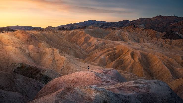
Death Valley National Park Overview
| Category | Details |
| Location | Straddling the California-Nevada border, east of the Sierra Nevada |
| Nearest towns | Lone Pine, CA; Beatty, NV |
| Nearest airport | Las Vegas Harry Reid International (LAS) |
| Established | February 11, 1933 (national monument); October 31, 1994 (national park) |
| Total area | About 3.4 million acres — the largest national park in the contiguous U.S. |
| Vehicle entrance fee | $30, valid 7 consecutive days |
| Motorcycle fee | $25 |
| Per-person fee (foot/bicycle) | $15 |
| Death Valley Annual Pass | $55 |
| America the Beautiful Annual Pass | $80 (all U.S. national parks) |
| Payment method | Cashless — credit/debit card only |
| Lowest point | Badwater Basin, 282 feet below sea level |
| Highest recorded air temperature on Earth | 134°F at Furnace Creek, 1913 |
| Best time to visit | October through April |
| Annual visitation | Around 1.1 million visitors |
Where Death Valley National Park Is Located
Death Valley sits along the California-Nevada border, east of the Sierra Nevada, within the Mojave Desert. It’s the largest national park in the lower 48 states, spanning roughly 3.4 million acres, an area so vast that most visitors need to accept upfront they won’t see the whole park in a single trip.
Las Vegas Harry Reid International Airport is the most practical arrival point for most travelers, with roughly a two-hour drive to reach the park’s main hub at Furnace Creek. There’s no single gate controlling entry; visitors typically stop at an entrance station, visitor center, or automated kiosk to pay, since the park itself is open 24 hours a day, every day of the year.
Given the park’s size, planning matters more here than at most parks. Furnace Creek functions as the central hub, with lodging, a gas station, and the main visitor center, while Stovepipe Wells to the north offers a second, smaller services area. A stop that looks close together on a map can easily turn into a 30-to-45-minute drive once you’re actually navigating the park’s scale.
What It Costs to Visit
Entry costs $30 for a private vehicle, covering everyone inside for seven consecutive days. Motorcycles pay $25, and visitors on foot or bicycle pay $15 per person, with children 16 and under admitted free.
Regular visitors typically pick up the $55 Death Valley Annual Pass, which pays for itself after just two trips, while anyone planning visits to multiple national parks during the year tends to prefer the $80 America the Beautiful Pass, covering admission to every federal recreation site nationwide.
Death Valley has been entirely cashless since June 2023. Every entrance station, campground, and fee kiosk requires a credit or debit card, so visitors without one should plan to purchase a pass online in advance through Recreation.gov before arriving.
One current planning note worth checking before a trip: recent flood events have closed several notable sites for extended periods, including Scotty’s Castle, which has remained closed since 2015 with no confirmed reopening date, along with intermittent closures on roads like Titus Canyon and Lower Wildrose. Checking the park’s current alerts page before finalizing a route can save real frustration.
Facts That Make Death Valley a Land of Extremes
Badwater Basin, at 282 feet below sea level, marks the lowest point in North America, and remarkably, Telescope Peak rises to over 11,000 feet just 15 miles away, meaning the park contains one of the most dramatic elevation contrasts found anywhere in the National Park System.
The valley itself formed through a geological process called vertical block faulting roughly 30 million years ago, as the valley floor sank while the surrounding Amargosa and Panamint mountain ranges pushed upward, creating a roughly 3,000-square-mile rift valley. The massive salt pan at Badwater Basin covers approximately 200 square miles, a stark white expanse formed from evaporated ancient lakes.
Despite the brutal summer heat, the park supports surprising biodiversity, including desert bighorn sheep, kit foxes, and specialized plant life adapted to extreme aridity and heat, along with pupfish species found only in a handful of isolated springs across the valley.
The History Behind Death Valley National Park
The Timbisha Shoshone have called this valley home for more than a thousand years, referring to it as Tümpisa, meaning “rock paint,” a name drawn from the red ochre clay found throughout the region and traditionally used for face paint and healing. Non-Indigenous history came later, most famously in 1849, when a group of lost gold prospectors crossed the basin and gave it the name Death Valley after surviving a grueling, multi-week journey through the terrain.
Mining activity followed through the late 1800s, including the well-known 20-mule teams that hauled borax 165 miles across the desert starting in 1883, though most mining ultimately proved commercially unsustainable. Tourism interest grew instead, and on February 11, 1933, President Herbert Hoover designated the region Death Valley National Monument, setting aside nearly 2 million acres.
That designation came at a significant cost to the Timbisha Shoshone, whose ancestral homeland was effectively declared uninhabited wilderness despite generations of continuous habitation. The tribe was confined to a small reservation site at Furnace Creek, and for decades afterward, they remained landless in any meaningful legal sense, even after gaining federal recognition in 1982 and 1983.
The monument’s status changed dramatically on October 31, 1994, when President Bill Clinton signed the California Desert Protection Act, expanding the protected area by another 1.3 million acres and formally redesignating it Death Valley National Park, making it the largest national park in the contiguous United States. That same legislation directed federal officials to identify suitable land for a larger Timbisha Shoshone reservation, a process that finally culminated in 2000, when President Clinton signed the Timbisha Homeland Act, returning roughly 7,700 acres of land within and around the park to the tribe and establishing a permanent reservation at Furnace Creek.
Frequently Asked Questions
Q1. Is it actually dangerous to visit Death Valley in the summer?
Yes, genuinely. Summer daytime temperatures regularly exceed 120°F, and heat-related medical emergencies are common among unprepared visitors. If you must visit in summer, stick to early morning hours, carry far more water than seems necessary, and avoid strenuous hikes during peak afternoon heat.
Q2. Which entrance should I use depending on where I’m coming from?
Furnace Creek, in the southwest, is most accessible from Las Vegas or via CA-127, and offers the most services. Stovepipe Wells in the northwest works well coming from Ridgecrest or CA-190 west, while the Badwater entrance in the southeast suits travelers coming from CA-178 but has no services available.
Q3. Are Scotty’s Castle and other closed sites worth waiting for, or should I plan around them?
Plan around them for now. Scotty’s Castle has been closed since 2015 with no confirmed reopening timeline, and several roads face extended closures from flood damage. Check the park’s current alerts page before your trip so you’re not disappointed by an unreachable destination.
Q4. Do I need a high-clearance or 4WD vehicle to see the park’s main attractions?
No. Furnace Creek, Badwater Basin, Zabriskie Point, and Artists Palette are all accessible via paved roads suitable for standard passenger cars. Only some of the park’s more remote backcountry routes require higher clearance or 4WD vehicles.