Drive through miles of dry, rugged desert in south-central Utah, and then suddenly the land drops into a ribbon of green: fruit trees, open grassy fields, and a historic farming settlement that, by any logic, shouldn’t have survived in this landscape at all. That’s Fruita, the small Mormon community preserved at the heart of Capitol Reef National Park, still growing apples, apricots, and cherries that visitors are welcome to pick straight from the trees, all within sight of the 100-mile geological formation that gives the park its name.
Here’s the practical guide for anyone planning a visit: where the park sits, what it costs, the numbers behind its unusual “reef” of rock, and how a determined Mormon farming community and a persistent rural doctor helped protect this stretch of Utah desert.
Capitol Reef National Park Overview
| Category | Details |
| Location | South-central Utah, along Highway 24 |
| Nearest towns | Torrey, UT; Bicknell, UT |
| Nearest airport | Salt Lake City International (SLC), about 3.5–4 hours away |
| Established | National monument on August 2, 1937; national park on December 18, 1971 |
| Total area | About 378 square miles (roughly 242,000 acres) |
| Entrance fee | Free along Highway 24 and Fruita front country; $20 per vehicle to drive Scenic Drive beyond the campground |
| Per-person fee | $10 (foot/bicycle) |
| Motorcycle fee | $15 |
| Capitol Reef Annual Pass | $35 |
| America the Beautiful Annual Pass | $80 (all U.S. national parks) |
| International visitor surcharge | None — Capitol Reef is not among the surcharge parks |
| Waterpocket Fold length | About 100 miles |
| Highest point | Near Billings Pass, 8,960 feet |
| Annual visitation | Around 1 million visitors |
Where Capitol Reef National Park Is Located
Capitol Reef sits in south-central Utah, with Highway 24 running directly through its middle from east to west, making it one of the more drive-through-friendly national parks in the state. The nearest towns, Torrey and Bicknell, offer lodging and dining, though the park itself has no restaurants, gas stations, or grocery stores within its boundaries.
Salt Lake City International Airport is the most practical arrival point for most travelers, though the drive south runs roughly three and a half to four hours, since Capitol Reef sits further from major population centers than several of Utah’s other “Mighty 5” parks. Its relative remoteness, especially compared to Zion or Arches, tends to mean smaller crowds even during peak season.
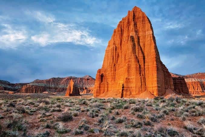
The park’s centerpiece is the Waterpocket Fold, a nearly 100-mile-long uplifted ridge of rock that runs north to south through the park like a spine, formed by the same continental collision that helped create the Rocky Mountains. Highway 24 and the paved, roughly 8-mile Scenic Drive both offer accessible ways to see this formation without committing to backcountry hiking.
What It Costs to Visit
Capitol Reef has an unusual fee structure worth understanding before your trip: much of the park, including Highway 24 through the middle and the Fruita front country area near the visitor center, is completely free to access. A fee applies only to driving the Scenic Drive beyond the Fruita Campground, where a vehicle pass costs $20 for seven consecutive days, individuals on foot or bicycle pay $10, and motorcycles pay $15.
Frequent visitors can pick up the $35 Capitol Reef Annual Pass, while anyone planning trips to multiple national parks during the year typically prefers the $80 America the Beautiful Pass, which pays for itself quickly if you’re touring Utah’s other Mighty 5 parks on the same trip. Capitol Reef is not among the eleven parks currently charging the additional nonresident surcharge, so international visitors pay the same rate as U.S. citizens here.
Backcountry camping, canyoneering, and climbing all require free permits available at the visitor center, and the Fruita Campground charges its own nightly fee separate from the Scenic Drive entrance cost.
Facts That Make Capitol Reef Unique
The park takes its name from two separate observations by early settlers: the white domes of Navajo sandstone reminded them of the U.S. Capitol building in Washington, D.C., while the Waterpocket Fold itself formed such an imposing barrier to travel that it earned comparisons to a coral reef blocking passage. Together, those two impressions produced the park’s distinctive name.
Fruita, the small Mormon settlement preserved near the visitor center, remains one of the park’s most surprising features. Settlers who arrived in the late 1800s used gravity-fed irrigation to coax orchards of apples, apricots, peaches, pears, cherries, and plums out of otherwise unforgiving desert soil, and those same orchards still produce fruit today, which visitors are welcome to pick during harvest season.
The park’s rugged, twisting canyons carry their own outlaw legend, too: the terrain reportedly served as a hideout for Butch Cassidy and the Wild Bunch during their outlaw years, drawn to the area’s maze-like isolation and difficulty of access. Pre-Columbian petroglyphs left by the Fremont culture, who inhabited the region from roughly 800 to 1300 AD, remain visible on several of the park’s smooth cliff walls today.
The History Behind Capitol Reef National Park
Long before any of its modern designations, the Fremont people lived in and around this landscape for centuries, leaving behind rock art and dwelling sites still studied by archaeologists today. Mormon settlers arrived in the late 1870s and 1880s, establishing the community of Fruita along with smaller settlements at Caineville and Aldridge, though the latter two eventually failed due to repeated flooding along the Fremont River. Fruita alone survived and thrived, sustained by its productive orchards sold to neighboring communities for decades.
Advocacy for federal protection built through the 1920s and 1930s under what locals called the “Wayne Wonderland” campaign, championed by figures including local booster E.P. Pectol and Dr. A.L. Inglesby, a rural physician who settled in the Fruita Valley in 1936. Their persistence paid off on August 2, 1937, when President Franklin D. Roosevelt signed a proclamation establishing Capitol Reef National Monument. Development proceeded slowly afterward; paved roads didn’t reach the area until the early 1960s, nearly three decades after the monument’s creation, and the Civilian Conservation Corps established work camps here during the late 1930s and early 1940s.
Full national park status arrived decades later, on December 18, 1971, when Congress passed the National Parks and Recreation Act, redesignating the site Capitol Reef National Park and expanding its protected acreage to preserve both the Waterpocket Fold and the historic remnants of Fruita, including its schoolhouse, orchards, and homestead buildings, many of which remain preserved and open to visitors today.
Frequently Asked Questions
Q1. Can I visit Capitol Reef without paying any entrance fee?
Yes, largely. Highway 24 through the park and the Fruita front country area, including the historic schoolhouse and orchards, are free to access. The fee only applies if you drive the Scenic Drive past the Fruita Campground.
Q2. Can I really pick fruit from the orchards, and does it cost anything?
Yes. Visitors are welcome to pick and eat fruit for free while walking through the orchards during harvest season. Fruit taken out of the orchard in significant quantities is typically weighed and paid for at a self-service station.
Q3. Is there anywhere to buy food, gas, or supplies inside the park?
No, Capitol Reef has no restaurants, grocery stores, or gas stations within its boundaries. Stock up in Torrey or Bicknell before entering, since the nearest services outside the park can be a genuine drive away depending on which direction you’re headed.
Q4. Do I need a permit to hike the Waterpocket Fold’s remote backcountry trails?
Day hikes generally don’t require a permit, but any overnight backcountry camping does, and it’s free and available at the visitor center. Canyoneering and technical climbing also require free permits, so plan to stop by before attempting either activity.